Corangamite Regional Floodplain Management Strategy
Public consultation on the draft Strategy has now closed. The Senior Steering Commitee plans to release the final Strategy in early 2018.
Since the 2010-11 floods, work has been done to improve flood mapping, flood warning systems and community flood awareness for individual towns, but as a region there is still work to be done.
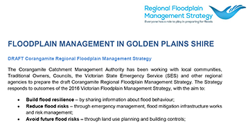
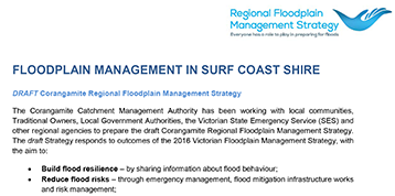
The Corangamite Catchment Management Authority has been working with local communities, Traditional Owners, Local Government Authorities, the Victorian State Emergency Service (VICSES) and other regional agencies to prepare the Corangamite Regional Floodplain Management Strategy. The draft strategy responds to outcomes of the 2016 Victorian Floodplain Management Strategy, with the aim to:
- Build flood resilience – by sharing information about flood behaviour;
- Reduce flood risks – through emergency management, flood mitigation infrastructure works and activities, and risk management;
- Avoid future flood risks – through land use planning and building controls;
- Manage residual flood risks – through flood insurance, sharing flood risk information, integrated flood emergency management and incident control.
- Protect floodplains for their ecological and cultural values – by integrating the management of flood risks with protecting the environmental and cultural values of natural floodplains.
Frequently Asked Questions - Draft Corangamite Regional Floodplain Management Strategy
The Corangamite Catchment Management Authority has coordinated the development of the draft Strategy in collaboration with regional stakeholders. The Corangamite CMA invited key stakeholders to be represented on a Senior Steering Committee to provide oversight and guide the development of the Strategy within the scope of policies, actions and accountabilities outlined in the Victorian Floodplain Management Strategy.
The Senior Steering Committee includes representatives from each of the six major local government authorities (LGAs) in the region, VICSES and the Corangamite CMA. Five Senior Steering Committee meetings have been held to date, with additional engagement outside these meetings as required. There was also one-to-one consultation with two other LGAs in the region – the Borough of Queenscliffe and Moyne Shire. Additional engagement also occurred with other regional stakeholders, such as coastal committees of management, water corporations and VicRoads
Traditional Owners in the Corangamite region were also engaged through face-to-face meetings. The Traditional Owners provided valuable insights into how intrinsically environmental and cultural values are linked, and the importance of community education.
The draft Strategy will be delivered in partnership with LGAs, the VICSES and the Corangamite CMA as well as other relevant agencies. Responsibility for delivering the draft Strategy is shared between stakeholders, with the lead agency identified for each action in Chapter Four being responsible for the action’s implementation.
Chapter Five of the draft Strategy outlines the proposed approach to Monitoring, Evaluation, Reporting and Improvement.
Development of the draft Strategy has been funded by the Victorian government, following the policy recommendation in the Victorian Floodplain Management Strategy that ‘Victoria’s floodplain management priorities will be established through Regional Floodplain Management Strategies.’
The draft Strategy focuses on flooding associated with river systems (riverine flooding) and coastal storm surge inundation. In considering coastal storm surge inundation, the Strategy includes planning for projected sea level rise scenarios.
The draft Strategy does not include actions relating to stormwater flooding or rural drainage. The Victorian Rural Drainage Strategy is under development and will be released in late 2017. Stormwater flood risks are the responsibility of the LGA as outlined in the Victorian Floodplain Management Strategy and, therefore, are best dealt with through local government planning processes.
Priority flood risks were determined through two phases:
- A rapid appraisal of flood risks and
- Stakeholder consultation
The rapid appraisal of flood risk methodology (see Chapter Two) provided a regional snapshot of flood risks in the region, distinguished by management units (e.g. a township). Flood risks were rated for each management unit as either high, medium or low. This risk assessment was then used as a starting point for discussions around flood risks within the region (stakeholder consultation). A series of workshops were held with each of the LGAs, VICSES and additional stakeholders to discuss/ verify and amend the flood risk ratings. Information from both the rapid appraisal and stakeholder consultation phases was consolidated for each management unit to determine the final flood risk ratings for the entire region (see Table 9, page 40).
Flood damages can change over time due to changes to land use, development or climate. The risks presented in the Strategy are based on knowledge of the Corangamite region at present, and do not factor in potential future changes in population, land use or climate.
The information from the risk assessment was then used to determine priority actions for mitigation floods in the region over the 10 year life of the Strategy. Priority actions are those where:
- The regional risk assessment identified a significant risk for the location.
- The existing mitigation measures are considered inadequate.
- Additional mitigation measure(s) may reduce flood risk.
- Additional mitigation measure(s) are financially, socially and environmentally feasible.
- Each responsible party considers the action achievable, subject to funding and resourcing, over the lifetime of this Strategy.
Priority actions are outlined in Chapter Four. The implementation of any of the actions is subject to funding and feasibility.
The Strategy is a high-level strategic document. It is not a property scale document. The Strategy will not develop individual or localised projects (for example flood studies, planning scheme amendments and structural works). Such projects have been identified as actions in the draft Strategy.
Preventing flooding is problematic and ineffective. Physical infrastructure options (e.g. levees) can protect human activities to some extent but can never protect against all floods. They are often expensive, have negative effects on the environment and flood behavior and create significant problems when they fail or are overtopped. The most effective flood mitigation options include sound planning, and education.
Having said that, in some in cases flood mitigation infrastructure is the only option and where a key stakeholder, for instance, the LGA has identified a need to include an action regarding flood mitigation
infrastructure it has been included in the Strategy. Section 2.2. page 24 of the draft Strategy outlines the current management arrangements for flood mitigation infrastructure and future management.
The draft Strategy does not include information on flood risk insurance for landowners. Flood risk insurance is best dealt with at a state level and there are a number of actions identified in Section 17 of the Victorian Floodplain Management Strategy regarding flood insurance. For example, DELWP will work with the insurance industry to facilitate an exchange of flood risk mapping and other flood risk information to ensure insurance is fairly priced. To date the information shared with the insurance industry has contributed to average reduction of 7% in flood insurance premiums.
Development and construction standards in Victoria will continue to be based on the 1% Annual Exceedance Probability flood event (1 in 100 year flood event). The Corangamite Catchment Management Authority will continue to provide advice and support to local councils to identify areas at risk.
As part of the changes proposed in the draft Strategy, local flood studies will include a draft planning scheme amendment that identifies the areas at risk. This approach will help streamline planning scheme amendments and ensure flooding is considered as part of the planning permit approvals process.
Council brochures
DRAFT Corangamite Regional Floodplain Management Strategy
-

445kb
DRAFT Corangamite Regional Floodplain Management Strategy
-
643kb
Draft Corangamite Regional Floodplain Management Strategy
-
541kb
DRAFT Corangamite Regional Floodplain Management Strategy
-
726kb
DRAFT Corangamite Regional Floodplain Management Strategy
-
657kb